Developing a new model for urban flood prediction and prevention
I finished my master thesis in 2017 and now, a year later, I was honored by the Swedish Hydrological Council with the award of best master thesis within hydrology. However, the best rewards for me were the learning process and getting to see my work coming to use in novel research. This is how I became a PhD student working with nature-based solutions, flood control and ecosystem services in cities.
As I started the fourth year of the civil engineering program, in technical mathematics, I wanted to learn how to apply my math and programming skills to a societal and environmental challenge. My interest in climate mitigation and adaptation led me to look outside the math department. While searching I stumbled upon cloudburst flood modelling and maps of flooded cities. I remembered how much I used to like maps when I was younger and preventing floods seemed like exciting work. I found out what courses were relevant in this field by contacting practitioners and professors. They told me about rainfall run-off modelling, geographical information systems (GIS) and an internship course. During that valuable internship, I spent half a semester at Tyréns in Malmö doing hands-on modelling and there I got to evaluate various flood models.
At the time to write my thesis I found an interdisciplinary research project, between the division of water resource engineering and Lund GIS Centre, where I could explore both old and new flood models. It turned out that the researchers at Lund GIS Centre had developed an algorithm for accurate flow pattern estimations suitable for rural landscapes. They handed me the algorithm as program code and suggested that I should setup a new model. Such a model, they hoped, could provide knowledge on which houses might be at risk of flooding. A bit overwhelmed by their expectations, I started my work by just trying to understand the algorithm. Through trial, error and discussions with my supervisors, we eventually came up with some ideas on how to develop a model that estimates the water depths during extreme cloudburst events.
Trial and error took effort and hard work and sometimes it made me doubt my capability to setup a new model. Writing a master thesis is very different from taking courses: you are working on your own and you cannot be sure of the outcome. Therefore, I approached researchers at different departments, presenting my ideas and asking for feedback. Their responses entailed new questions and challenges, but they definitely gave me a better understanding of the hydrological processes and how to represent them in my model.
During my thesis, I found the process of programming to be very rewarding as it let me be creative and design my own code. Eventually I managed to design a program where the user can input geographical data and preferred rainfall and the model generates flood maps! After finishing my thesis, I was lucky to get a shorter employment at the GIS Centre, to develop the model further, for other researchers to make use of it when estimating glacial lake flood events.
While finishing my thesis, I saw an ad for a PhD position and today I am doing research on nature-based solutions and multiple ecosystem services in cities. Now I am looking into how nature-based solutions, e.g. parks, ponds and raingardens, can mitigate floods, provide aesthetics and recreation. Essentially, I am doing quantitative research that can help landscape architects and urban planners in their work on creating attractive and resilient cities. It is very challenging and exciting.
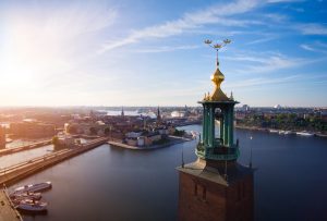
During the upcoming World Water Week 2018 I will be engaged as a junior rapporteur and therefore I hope to see you in Stockholm in the end of august!

